4.2.1 An Overview of the Project of the Three-Way ...
Nanjing Wei San Road Crossing Channel is located between Nanjing Yangtze River Tunnel(Nanjing Wei Qi Road Crossing Tunnel)and Nanjing Yangtze River Bridge.It is the traffic artery connecting Pukou New Town and Nanjing Main Town,and its location is shown in Fig.4.4.Starting from the intersection of directional river and Puzhu road,the project sets the main tunnel toll station along the directional river south to Fengzi river road,and then converts the horizontal and vertical alignment in the open cut section,and introduces the vehicle into the double-layer tunnel of the south and north lines.After heading north at the directional estuary to avoid the deep trough of the estuary,the shield tunnels of the south and north lines are separated:the south line tunnel passes through Qianzhou and Jiangxinzhou successively and goes to shore at the intersection of Yangtze River Avenue and Dinghuaimen Avenue,with a total length of 7.363 km(a total length of 4.135 km).The north line tunnel is 7.339 km long(3.537 km long)from the upper reaches of the Qinhuai River estuary after crossing the submarine.Nanjing Wei San Road crossing channel is designed for two-way double eight lanes,single pipe has independent capacity.
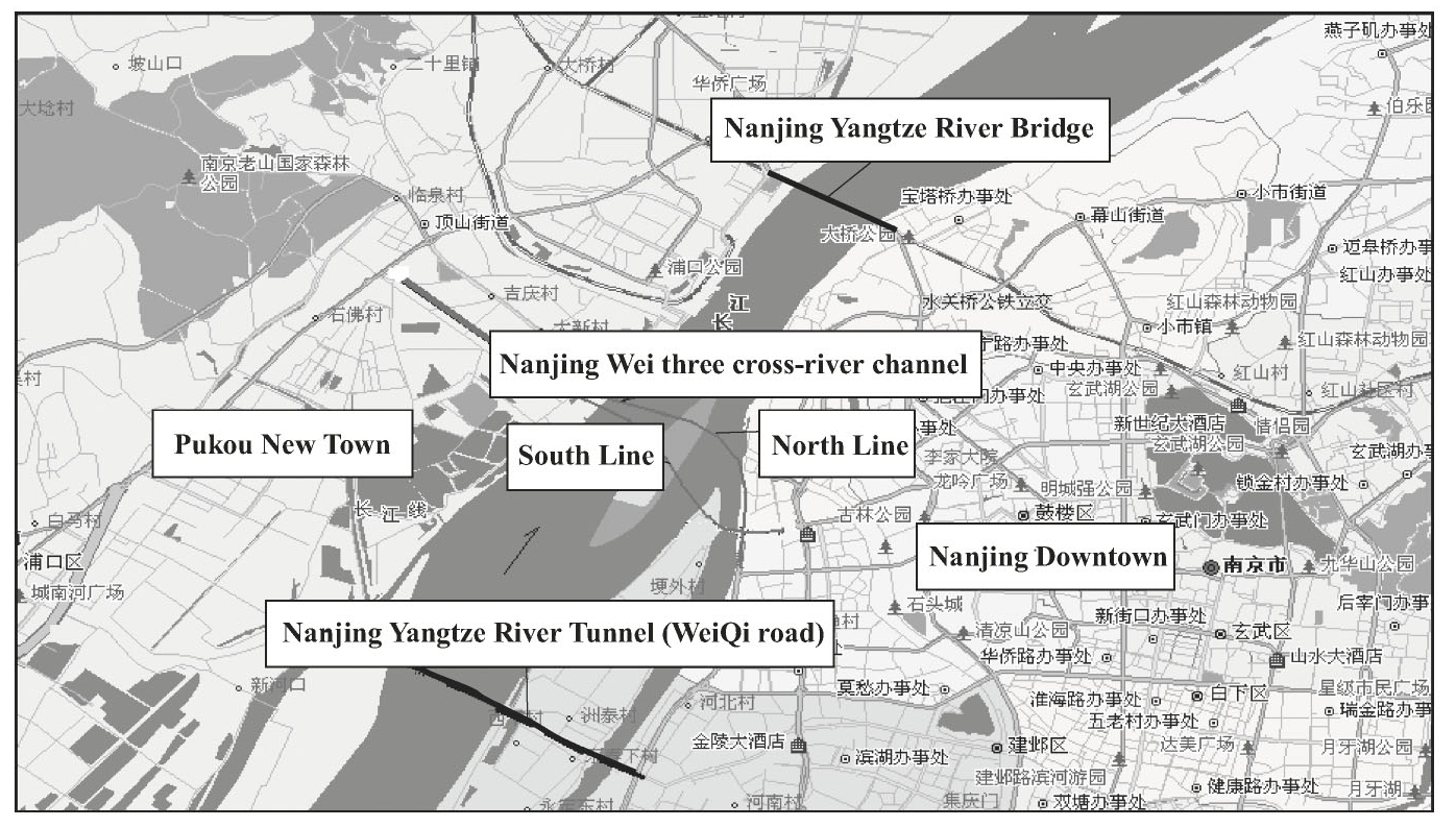
Fig.4.4 Location of the Nanjing Wei San Road Crossing Channel Project
The site of Nanjing Wei San Road crossing the Yangtze Riveris mainly the Yangtze River alluvial plain,the Yangtze River waters and the river center.The Nanjing Yangtze River levee on both sides of the Yangtze River waters is a high-level levee,which is the key water conservancy facilities for its crossing.The settlement and stability control of shield construction are very important.The near-water sides of the embankments on both sides of the South and the North are mortar block stone feet and dry block stone slopes,and the annual average high water level of the Yangtze River is 8.37 m.Small structural stiffness,poor integrity,high water level,a small amount of settlement and horizontal deformation will endanger the safety of the embankment.When a large displacement occurs in the soil of the slope facing the water surface,the upper soil of the slope will move and even slide.Surface,triggering the overall sliding of the embankment slope.Moreover,the shallow overburden at the river bottom and the great variation of overburden depth at the bank slope increase the difficulty of shield tunneling under the bank.Therefore,it is necessary to analyze the influence of shield construction on the bank settlement and slope stability,and establish reasonable construction control indexes to ensure the smooth passage of large-diameter slurry shield.(https://www.daowen.com)
This section takes the south line project crossing the north bank embankment as an example as an example for analysis.The corresponding interval mileage pile number SDK4+350-SDK4+850,the slope length of the embankment facing the water surface is about 180 m,and the slope height is 36 m.The stratigraphic distribution is shown in Fig.4.5.