4.2.2 Calculation Model and Parameters
Fig.4.5 shows the downward slope of the tunnel when crossing the embankment.In order to simplify the calculation,it is considered that the tunnel axis level,that is,the slope model of the tunnel does not change.According to the actual working condition of Nanjing Wei San Road crossing the river channel,a semi-model is established based on the symmetry principle.The shield diameter is 15 m,the longitudinal dimension is 500 m,the transverse dimension is 100 m,and the vertical dimension is 74.5-110.5 m,with a total of 50,832 units and 55,349 nodes.The formation unit adopts the Mohr-Coulomb constitutive model and the isotropic fluid model considering the seepage effect.The initial pore pressure of the model is calculated automatically by the water level.The normal displacement is constrained by the bottom boundary and the front,rear,left and right boundaries of the model.The bottom boundary and the left and right boundaries are permeable boundaries.The front and rear boundaries are impervious boundaries.The displacement and seepage of the top boundary of the model are free boundaries.The shield shell is simulated by shell element,and the lining segment is simulated by lining element.It is assumed that the constitutive relations are elastic,and the stiffness of segment ring is corrected according to the method.The correction coefficient is 0.75.The grouting behind the wall is simulated by“three stage consolidation cementation”elastic equivalent layer and shield tail clearance element,assuming that the filling rate of grouting body is 85%.The calculation model is shown in Fig.4.6.According to the geological survey report and the experimental results of field soil,the relevant calculation parameters are shown in Table 4.1.
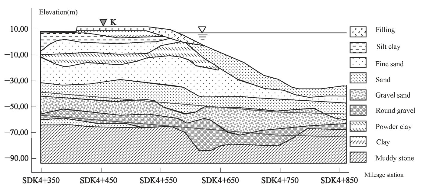
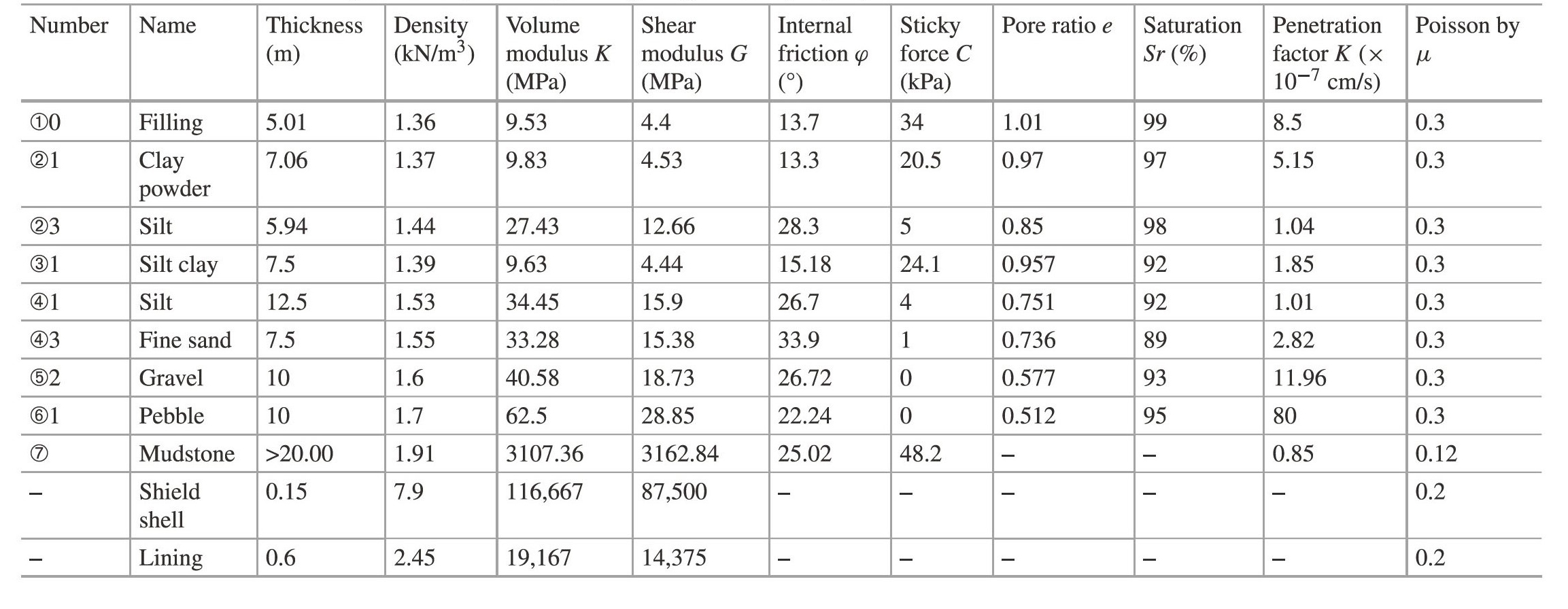
Fig.4.5 Schematic diagram of the shield crossing the embankment stratum(sdk4+350~sdk4+850)
Fig.4.6 Schematic diagram of the numerical calculation model
Table 4.1 Numerical calculation parameters(according to the geological survey report)